
|
|
|
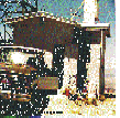
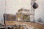
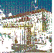
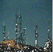
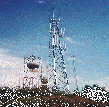
| Click on any of the 'thumbnail' sketches for more information and pictures of the site. | |
|
|
 |
 |
|
Chuckwalla - This site covers Interstate 10 from Chiriaco Summit to Blythe and north on State Highway 62 to Vidal Junction. |
Frazier Mountain - Frazier provides coverage of the San Joaquin Valley as far north as Fresno and the Mojave Desert east to Victorville. | Guadalupe Peak - This site covers the route along Interstate10 west of Blythe, at the California and Arizona border eastward towards Phoenix. | Mount Laguna - This site covers the Eastern San Diego County area and much of Imperial County. |
 |
|
 |
 |
|
Mount Lukens - This site covers the Los Angeles Basin and San Fernando Valley area. |
Signal Peak - This site covers all of the Orange County area, Southern Los Angeles County and Northern San Diego County. |
Snow Peak - This site covers the route along Interstate10 from Pomona to Cactus City, along with stellar coverage of the Coachella Valley and Palm Springs. |
Sunset Ridge - This site covers Southern Los Angeles County, Orange County and much of Riverside and San Bernardino County areas. |
Return to:
|
|
Revised: March 9, 2023 by K6IYK
Copyright 2011-2023 by Cactus Intertie, Inc. All Rights Reserved
The Cactus Radio Club, Inc. logo, "Cactus Intertie, Inc.", "Cactus Radio Club, Inc.",
"Cactus Intertie" and
"Cactus Intertie System" are registered trademarks of Cactus Intertie, Inc.
No use of these symbols or phrases is allowed without the express
written permission of Cactus Intertie, Inc.